
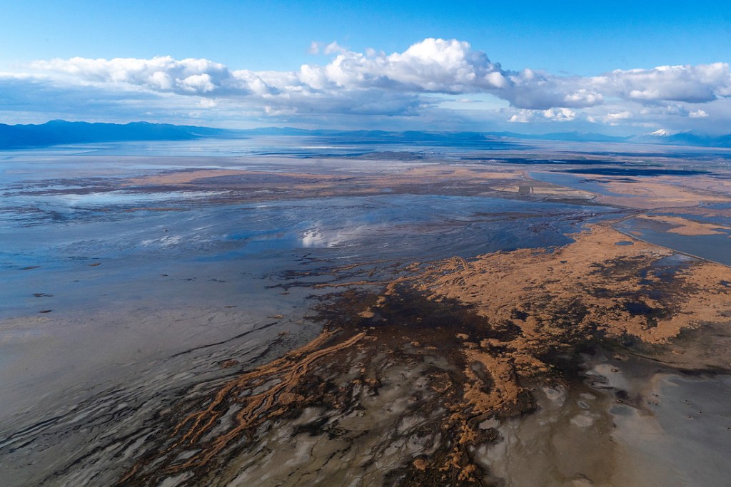
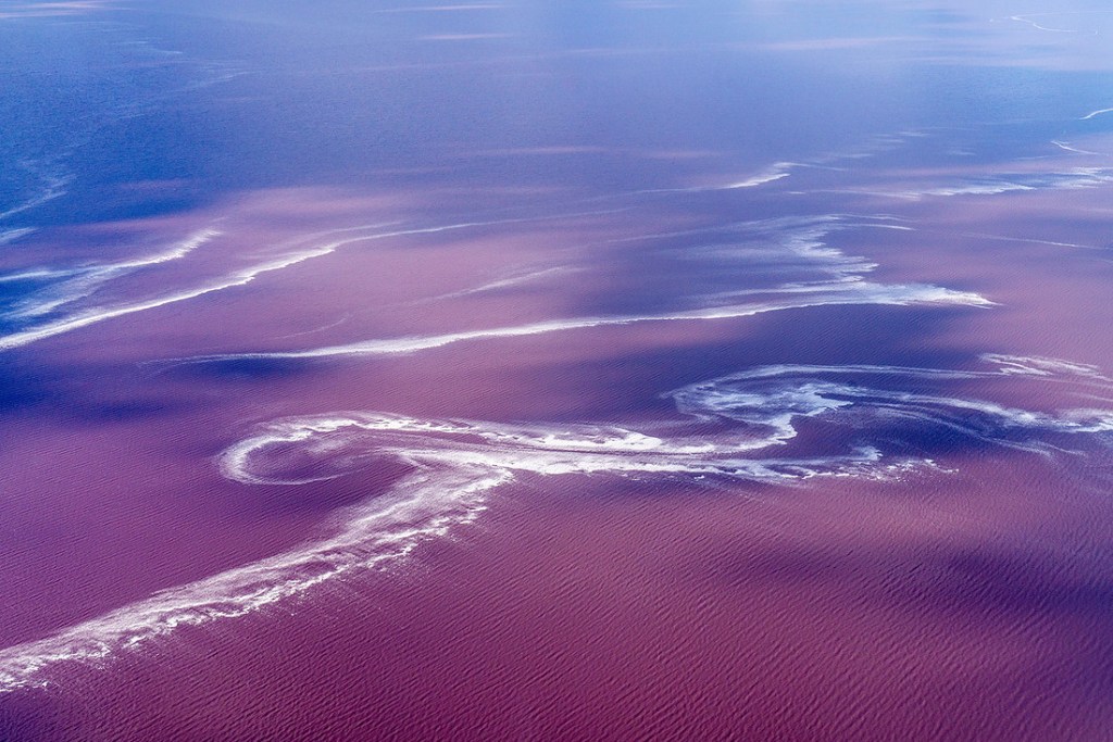
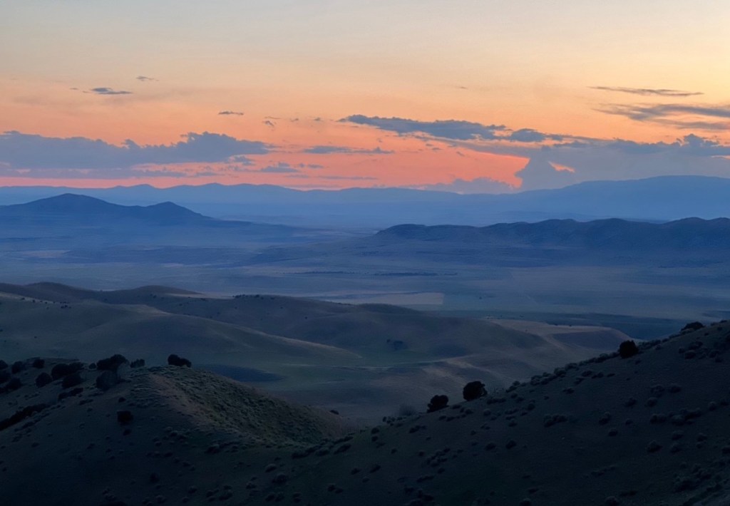
Pooling between the arms of the Wasatch Mountains, Pi’a-pa glitters with minerals, brine shrimp, insect wings, and blue and white bird feathers. Marshes and salt flats bleed from the shore in a patchwork of spongy and mirror-like terrain. It all melts into rose gold come sunset. With roots reaching back to prehistoric freshwater, this is an ancient potion first frothed in the Pleistocene Epoch.
In 2026, the Great Salt Lake is only 34.3% full.
Pi’a-pa is the largest watery remnant of Lake Bonneville, which, after forming 30,000 years ago, covered 20,000 square miles of the American West, including my birthstate of Utah. Glacial periods would flood more freshwater into the behemoth basin. This would drain into the Snake River, which carried it through my homestate of Washington and to the Pacific Ocean in a journey of mountain and tide that, largely, has mirrored my own mobility. Interglacial and postglacial eras, however, would see lessened water levels and a cutting off from exit points like the Snake River. As rivers carried minerals into the basin, and with evaporation as the only way out, salt found a home.
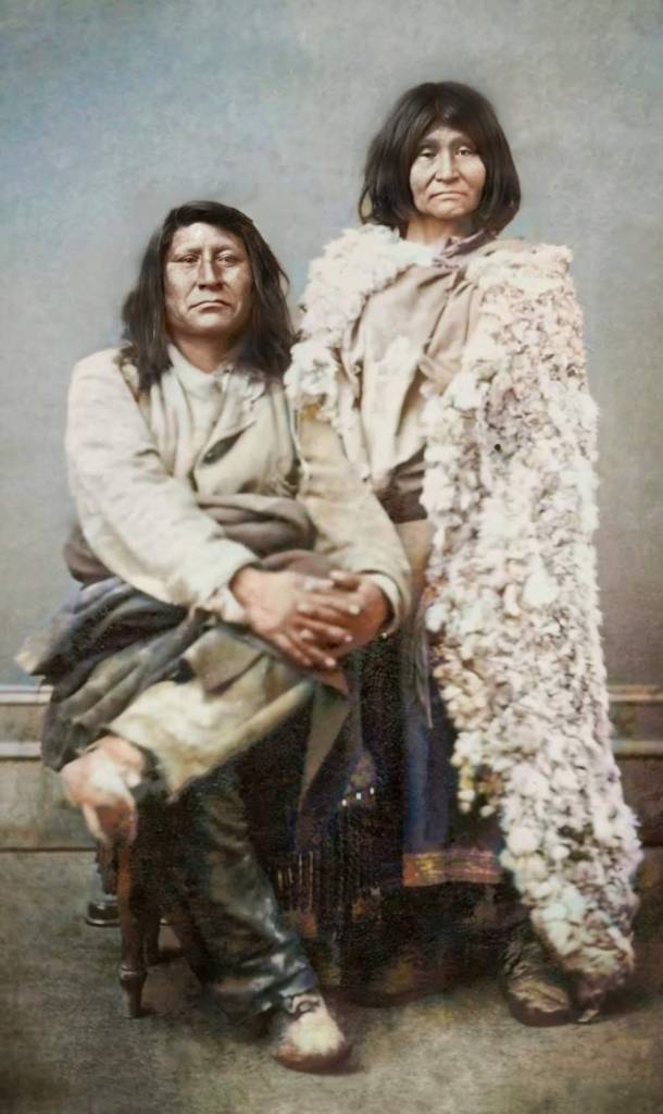
By the time the Great Salt Lake took shape, humans entered the picture. In this way, people and Pi’a-pa have always been tethered to each other in a sort of sibling connection; as kinfolk. Back when humans and the Great Salt Lake were born, the terrain was lush with the sounds of springs, wetland ripples, mammoth groans, and the rustling of giant ground sloths. Indigenous communities of present-day Shoshone, Goshute, Ute, and Paiute ancestors found a life on these jade-hued shores.
Every year, millions of tons of salt gush into Great Salt Lake from the Jordan, Bear, and Weber rivers, joining the 5 billion tons of minerals that sit in the basin. Among this accumulation are chloride and sodium, but magnesium, sulfate, and potassium are present as well. The lake can be 10 times more salty than the ocean. For thousands of years, the Newe, or people, have carefully harvested this salt to preserve their dried meats through harsh winters and trade. For these Indigenous communities, salt was survival. Today, salt is heritage.
Subduing Pia-Okwai, Kui-o-gwa, and O’o-gwa
When my paternal grandmother’s ancestors arrived in 1853 with the Wilford Woodruff Company, Brigham Young had already supposedly proclaimed, “This is the place” over the valley 6 years earlier. By the time my paternal grandfather’s ancestors arrived in the early 1900s from Denmark, the infrastructure had been changed drastically by Mormons for over half a century.
The Jordan River connects the Great Salt Lake to Utah Lake. This 51-mile river was named by white people after the biblical body of water by the same name in the Middle East. Heber C. Kimball originally called it the Western Jordan in 1847 in a deeply Mormon move to frame Utah as the Promised Land of the Americas. 3,000 years earlier, archaeological evidence shows that the river supported desert communities. It was also an important natural feature that shaped the lives of the Goshute and Western Shoshone. When Mormons came, they siphoned the waters off for irrigation, domestic uses, and power before criss-crossing it with ditches, canals, and dams, and shoving pumps in the ground (this tradition of irrigation and water usage continues to be the biggest threat to the Great Salt Lake). A fishery was also installed, with invasive common carp accounting for the most populous species. The waterway was used to send raw sewage away from white communities, into the Great Salt Lake. To keep it all from overflowing before its final destination, the channel was dredged, and its curved banks straightened. The water was further poisoned by mining, agricultural runoff, and waste from factories, slaughterhouses, and mills. Today, algal blooms flower on its banks.
The Western Shoshone call the Jordan River, Pia-Okwai.
European traders, part of the French and British Northwest Fur Company, noticed bears along what they later called the Bear River. On January 29, 1863, 10 years after my grandmother’s great-grandmother made it to Salt Lake and, at the age of 15, was married as a plural wife to the nearly 50-year-old Wilford Woodruff, the United States Army responded to the requests of local church members living in Cache Valley. 133 years before I was born in that same valley, as a church member, 500 (possibly more) Shoshone community members were slaughtered on the banks of the Bear River. Children were among them. Babies were among them. Women were raped before soldiers smashed their heads with axes. Shoshone food supplies and horses were stolen. Homes were burned. It’s still the deadliest slaughter in American history of Indigenous people.
Led by Porter Rockwell, Colonel Patrick Edward Connor and his band of men were praised before they killed the families by Deseret News, the Utah newspaper founded and funded by the Mormon church itself. The publication printed, “With ordinary good luck, the volunteers will wipe them out. . . . We wish this community rid of all such parties, and if Colonel Connor can be successful in reaching that bastard class of humans, who play with the lives of the peaceable and the law-abiding citizens in this way, we shall be pleased to acknowledge our obligations.”
Darren Parry, the former chairman of the Northwestern Band of the Shoshone Nation and author of The Bear River Massacre, A Shoshone History, grew up hearing stories of the slaughter from his grandmother, Mae Timbimboo Parry, whose grandfather Da-boo-zee (who later went by Yeager Timbimboo), the son of chief Sagwitch, was 12 years old when his community was slaughtered — he survived by listening to his grandmother, who told him to play dead. His granddaughter, Mae, is the reason the Bear River Massacre is no longer called the Battle of Bear River by the government.
When Sagwitch greeted the pioneers and their leaders when they arrived from Wyoming, the aforementioned Heber C. Kimball told him, “The land belongs to our father in heaven, and we calculate to plow and plant it; and no man shall have the power to sell his inheritance for he can not remove it; it belongs to the Lord.” A few months later, Mormons were frustrated that it was hard to find good free land. In 1856, the Mormon church asked Peter Maughan to bring a band of members to the valley that the Northwestern Shoshone called home. At first, the settlers called the tribe “the friendly ones,” but as they started using up the resources, the implants began seeing them as “thieves and beggars,” according to Parry.
In 1875, Sagwitch would say, “The white man is roaming all over my country and killing my game.”
“Still I make no objection to his doing so, and all I want is to be let alone, with the privilege of making a small farm for the benefit of my people, and to be allowed to live on it in peace. I have not gone into the white man’s country and intruded on him, and I do not think it is fair for him to come into mine and drive me from my own lands without any cause, and I ask the government to take the matter in hand and reinstate me and mine on our own lands, that we may live there in peace and friendship with all men.”
This was the same year that he met with my great-great-great-grandfather in Salt Lake City.
On the Mormon church’s official website, they call Sagwitch “an important ally and friend to Latter-day Saints.” The site goes on to say that after Sagwitch met with the settlers, a “positive and enduring relationship” began. When describing the Bear River Massacre, it says that after “skirmishes” erupted, “United States Army colonel Patrick Edward Connor, stationed at Camp Douglas on the east side of Salt Lake City, decided a preemptive strike on the Shoshone winter encampment near current-day Preston, Idaho, could curtail ongoing raiding and violence. On January 29, 1863, he dispatched a regiment to engage the Shoshone in battle.” The chief’s conversion to the Mormon church is detailed. So is his church-assisted relocation to “different farmland” under the United States Homestead Act. His surviving community members were moved to Washakie, Utah, 50 miles away from where their families were killed. It’s where Parry’s grandmother was born and attended a day school designed to, as the assimilation institutions’ mottos went, “Kill the Indian, and Save the Man.” But, in 1960, the Mormon church prepped to sell Washakie land by burning down the houses of residents who weren’t home. It’s now a ghost town.
Before he died and was buried in Washakie, Sagwitch and some of these displaced tribal members would build the Mormon temple in Logan. My aunts got married here. It’s where I received my endowments before serving a Mormon mission. It overlooks the hospital in which I was born. It overlooks what used to be my grandparents’ house. It overlooks my grandfather’s grave. It overlooks the canyon where, in my parents’ backpacks as a baby, I hiked for the first time.
In 2018, the Northwestern Shoshone were allowed to use the land again (if they purchased it), where, in 1863, their families were massacred.
On the night of January 27th of that year, Tin Dup, one of the elders in the tribe, had a dream that showed him “pony soldiers” killing the families. He warned everyone, and the families that believed him moved and survived the massacre. Others were warned by a friend who lived in the settlement called Franklin, who had heard local Mormons had planned to wipe out the tribe. Sagwitch’s wife and two of his sons would be killed by Colonel Connor’s men in the morning as the Bear River thawed. Shoshone families jumped into the freezing waters between the ice, trying to get away from the bullets and the blood. Parry’s great-great-grandfather played dead. Women threw their babies into the river. Children hid behind willow trees and shields made from the flexible wood. The snow and fallen linear-lanceolate leaves turned crimson. One of the chiefs, Bear Hunter, was shot, kicked, and tortured. When he would not make a sound, a soldier heated his bayonet in a fire and drove it through one of Bear Hunter’s ears, through his head, to the other ear. A husband and father, he died in silence on the banks of one of Great Salt Lake’s source rivers.
Local church leaders wrote to Brigham Young, when commenting on the massacre, “They rejected the way of life and salvation which had been pointed out to them from time to time . . . and thus have perished relying on their own strength and wisdom.” In the official minutes of a Logan ward meeting at the time, the secretary recorded, “We, the people of Cache Valley, looked upon the movement of Colonel Connor as an intervention of the Almighty, as the Indians had been a source of great annoyance to us for a long time.”
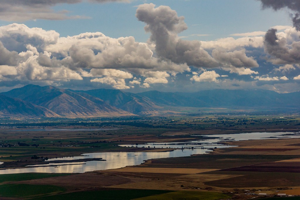
The Western Shoshone call the Bear River, Kui-o-gwa. They call Cache Valley, Sihiviogoi.
40 years earlier, Danish trapper John Henry Weber, the Weber River’s white namesake, camped with his Rocky Mountain fur trade company in Sihiviogoi. Jim Bridger was among the group, and he was asked to float down Kui-o-gwa to see where it led. The route took him to the Great Salt Lake, and he was given credit as the discoverer. Étienne Provost, a French trapper, came there before him, but he was not the first person who wandered the salt-crusted shores. The Danish trapper’s eponymous waterway also flows to Pi’a-pa, starting in the Uinta Mountains. From the Roof of Utah, the Weber River spills onto the soft mud flats before emptying into the lake. Disguised Wirelettuce, an endemic Northern Utah flowering plant, spreads light purple flowers along the river’s banks that Mormon pioneers followed to Salt Lake in 1847.
The Newe call the Weber River, O’o-gwa.
Dividing the waters
The Great Salt Lake is part of the Great Basin, which cups 200,000 square miles of Nevada, Wyoming, Oregon, California, and Utah landscapes. It was formed tens of millions of years back, when it was part of the Basin and Range Province — this North American series of mountains and valleys forged when the continent’s tectonic plates drifted away from each other. Left behind is the Great Salt Lake’s 21,000 square mile watershed. Pi’a-pa’s surface itself measures 1,700 square miles, with water that goes down 34 feet at its deepest point (the average depth, however, is just 14 feet). In 2022, the surface area of the Great Salt Lake shrank to 888 square miles.
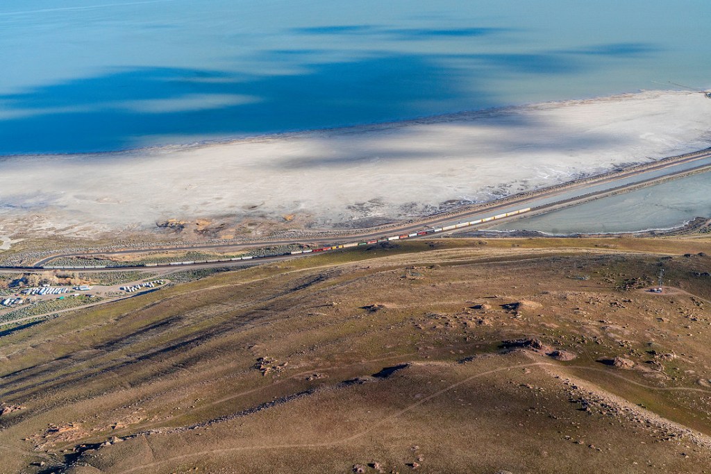
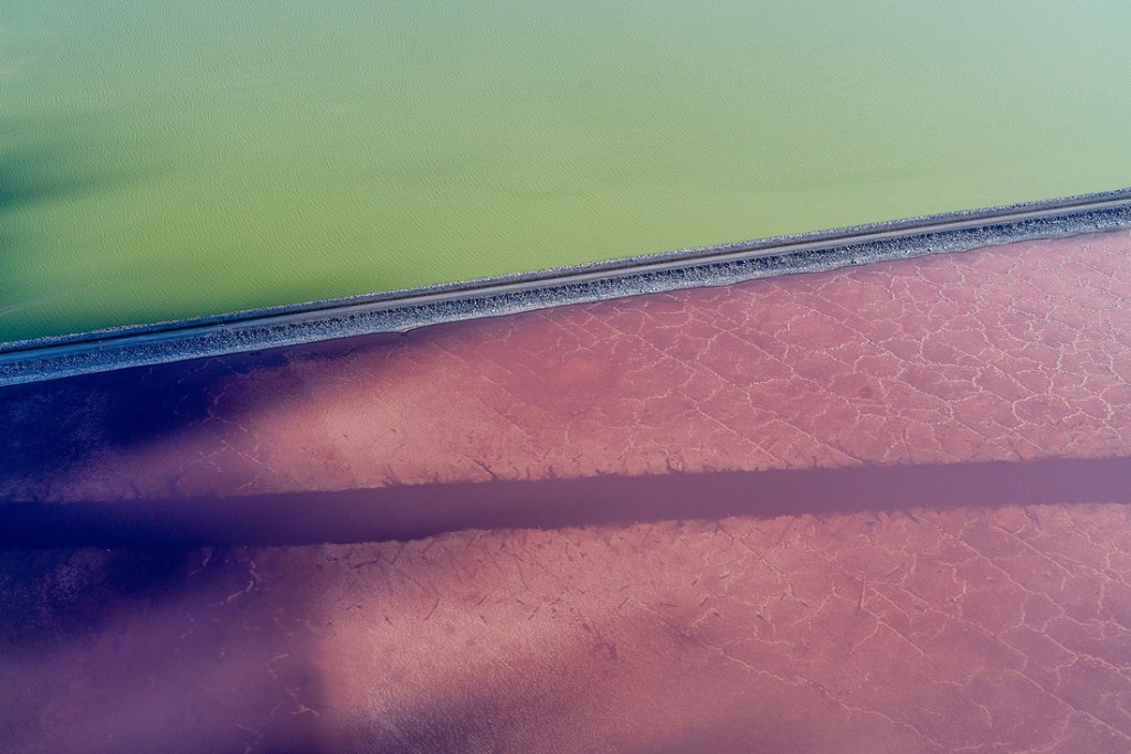
Since the Mormon pioneers settled in the valley, Pi’a-pa’s average volume has gone down about 67% due to the development and legacy of excessive water usage. The worst megadrought in the last 1,200 years hasn’t helped either, disrupting the climactic cycles that fed and defined the terrain. The lake was surveyed in 1850, when water levels were 19 feet higher, had 73% more water, and 60% more surface area. In 1869, when the first transcontinental railroad in the United States was completed, another survey was conducted, and the final spike for the tracks was hammered in along the northeastern shores of Pi’a-pa. 90 years later, an east-west causeway was constructed for more rail lines — the Lucin Cutoff is 30 miles long, and connects Ogden to Lucin. It also splits Pi’a-pa in two.
The northern piece of the lake is called Gunnison Bay. The southern piece is Gilbert Bay, where the main tributaries sit, and the water is several inches higher. Here, 11 little islands speckle Pi’a-pa, including Antelope and Fremont. The former is named after the pronghorn that lived there before the settlers hunted and displaced them with livestock shipped in and raised for the Mormon church. In 1993, pronghorn were reintroduced. Fremont Island was named after John C. Frémont, who was removed from his command by President Lincoln for freeing enslaved people in Missouri in 1861 (Lincoln re-enslaved them upon removing Frémont), was the country’s first presidential nominee for the Republican Party, was known as The Pathfinder as an explorer, and influenced Brigham Young to bring his church to the valley — Frémont also led multiple massacres that killed hundreds of Indigenous families across the American West.
Gilbert Bay, much less salty than Gunnison, supports brine shrimp and brine flies, which in turn feed millions of migratory fliers traveling the North American Pacific Flyway. Millions of gulls, pelicans, cormorants, herons, and terns gather along Pi’a-pa, bringing the dust of faraway terrains on their feathers. The shrimp also feed the bellies of farmed fish and millions of people. Shoreline duck eggs and insects feed the bellies of Shoshone communities. Pi’a-pa is sustenance.
As the Great Salt Lake’s water gets lower, the ratio of salt to water leans further in salt’s favor. High salinity, in turn, means higher evaporation rates and drier conditions. What’s left behind includes a mix of heavy metals like copper, arsenic, and lead that’s been fed by long-term agricultural and industrial runoff. As the water exposes more of the minerals and toxins, they enter the air in what experts are calling an “environmental nuclear bomb.”
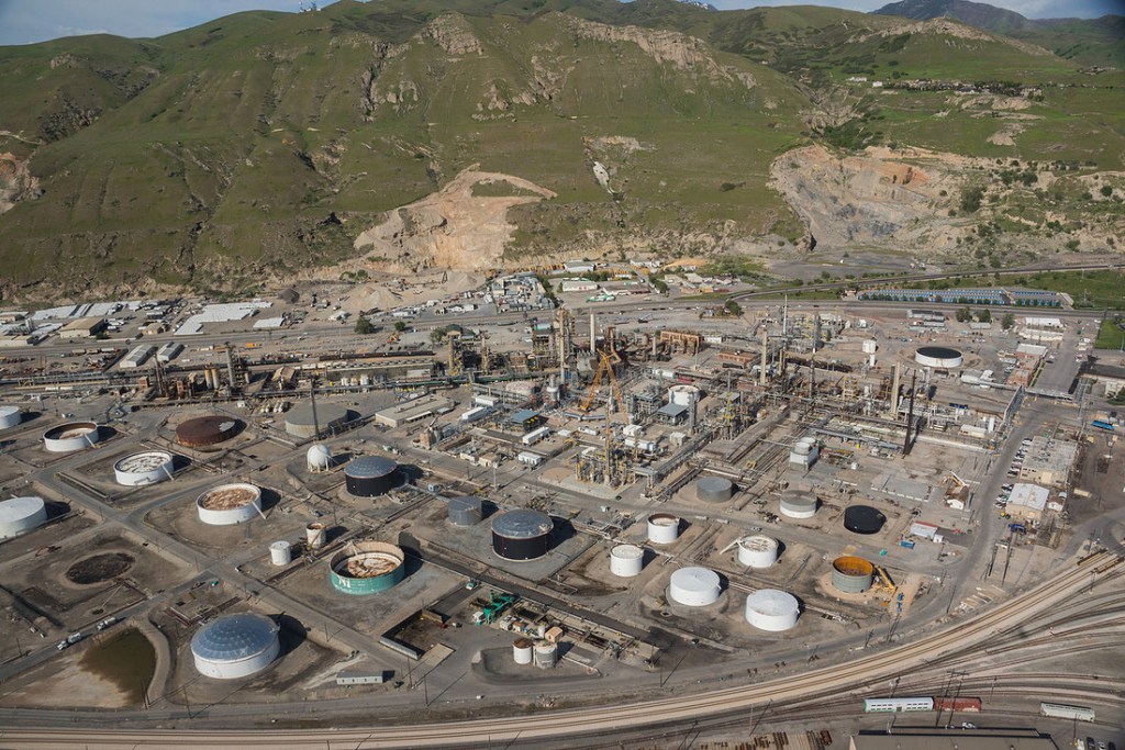
Industrializing downwind
Pi’a-pa is a keystone ecosystem to the Western Hemisphere. As the body that has long regulated the surrounding region’s climate gets thrown out of balance, so too does the surrounding region’s climate.
2026, less than 10 years before Salt Lake will host the Winter Olympics, is turning out to be the state’s worst year for snowpack on record. Less snow means less water flow. Less water flow means less water comes to the Great Salt Lake. Less water means higher salinity and higher evaporation rates. Higher evaporation rates mean more exposed toxins, dust storms, damaged crops, and both groundwater and air pollution.
While Pi’a-pa supports 80% of Utah’s wetlands, the watershed of the Great Salt Lake is also home to 80% of human Utahns. Its impending collapse is already killing people, sending up clouds of mercury, selenium, and arsenic as the lake desiccates. These elements are known to cause asthma, pneumonia, bronchitis, strokes, and heart attacks. As carcinogens, they also pose long-term cancer risks, especially for 1.8 million community members who live downwind.
Downwind is industrialized, and where redlining and community removals sent People of Color after white Utahns found it was too windy, and moved to higher, eastern ground. Based on research conducted by NASA and subsequent studies, the northwestern neighborhoods of Pacific Islanders and Hispanic people experience the worst of the desiccating lake’s pollution, with the former group facing the highest exposure levels as the Great Salt Lake dries up.
There are also 19,000 Indigenous people who live right on Pi’a-pa. The salted terrain is home to their burial grounds, the terrains their family members have looked at for millennia, residences, and, as mentioned, their harvesting sources.
Despite directly driving $2.5 billion in economic activity yearly, the Great Salt Lake’s surface area is 71% smaller than it was just 4 decades ago. Marinas used to send sailboats out onto the windy waters. Today, little ships tilt in the mineral muck, marooned; empty docks seem to grow out of the dust alongside the bones of bird colonies.
Greening the desert
Heritage is just as much a part of the Great Salt Lake as the water, minerals, playa, and brine shrimp are. Mormons floated blocks of granite along the Jordan River toward Salt Lake City to build their temple; the same temple that my parents got married in and that, almost exactly 100 years earlier, my great-great-great-grandfather would dedicate in 1893. This was the same year that the church opened Saltair, an amusement park on the lake that was framed as the “Coney Island of the West.” It used to attract about half a million people annually, who would float in the salty waters between dancing and riding the rollercoaster.
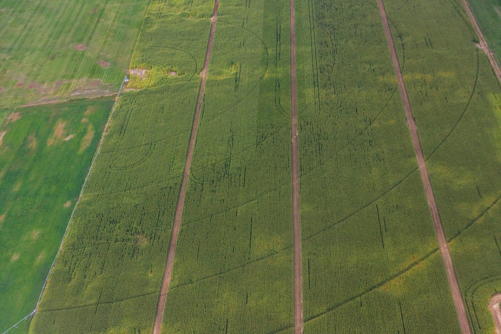
To make a home in the wilderness (a word that Parry says the Shoshone have no word for), my ancestors greened the desert. They saw terrain that they were unfamiliar with, and made it look more familiar; more like their ideas of Eden. They irrigated, fragmented, and altered Pi’a-pa until it was something that they could control. They colonized the water. This heritage of calculated use for the sake of the Mormon god, as Heber C. Kimball had once explained, is what now threatens to make Deseret unlivable and dangerous for Latter-Day Saints.
“The problem has never been a lack of science,” says Parry.
“It has never been a lack of intelligence, technology, or money. Our people understood water long before there were agencies to manage it. We understood that water is not a commodity to be bought, sold, or owned. We understood water as a relative. It is alive. It requires reciprocity.
“What we are witnessing is not a failure of engineering. It is a reflection of our values.”
These values, in Utah, are very clear and impossible to ignore. The state’s government is still largely run by Mormonism. The church has its fingerprints all over how members vote, and therefore, how the state’s leaders do as well.
In 2008, the church urged its members to support Proposition 8 in alignment with its stance on “same sex attraction” being a threat to marriage and family. In an official letter sent out to all Mormon leaders across California, where Prop 8 was being decided, the church said, “We ask that you do all you can to support the proposed constitutional amendment by donating of your means and time to assure that marriage in California is legally defined as being between a man and a woman.” When it was shot down in 2010, and marriage equality was protected, the church released an official statement saying it “regrets today’s decision,” and that “marriage between a man and woman is the bedrock of society.” The Mormon church released a nearly identical statement again in 2012. This came after the now-president of the church, Dallin H. Oaks said, in 2006, that “homosexual feelings are controllable,” and compared this “susceptibility” to that of “a strong temptation to steal,” “a taste for alcohol,” and “a susceptibility to anger.” In the same interview, he went on to suggest that, if a queer person asked to visit their parents and would bring their partner, members can respond with “Yes, come, but don’t expect to stay overnight. Don’t expect to be a lengthy house guest. Don’t expect us to take you out and introduce you to our friends, or to deal with you in a public situation that would imply our approval of your ‘partnership.’” The children of queer couples were given full rights to get baptized and blessed in 2019. 4 years later, President Oaks said that the church’s support for the federal Respect for Marriage Act “was not on same-sex marriage, but on ensuring the act contained the necessary protections for religious freedom… the Church publicly reaffirmed our Church doctrine approving only marriage between one man and one woman.” Today, the church’s official position on “same-sex attraction” is that “acting on it” is a sin, but if queer Mormons agree to live out a lifelong vow of chastity, they can retain membership. Though if they’re in non-straight passing marriages, their marriage isn’t recognized by the church, and their families cannot be sealed for eternity (in other words, they will be separated after death, according to the faith). It should be no surprise, then, that the Utah legislature pushes many anti-LGBTQIA2+ bills, rainbow flag bans, and a renaming of Harvey Milk Boulevard in Salt Lake City in favor of Charlie Kirk Boulevard.
As a queer ex-Mormon myself, with many close loved ones who are also queer, these facts both deeply anger me (or, as President Oaks might say, invoke “a susceptibility to anger”) and make me squirm — it’s my ancestors who built this church; it’s their church that harms their family members now. These same family members now choke on neurotoxins and heavy metals, and are living out the reality of what it really means to green the desert. These aren’t separate issues — Mormonism is a deeply interconnected web of choices. Like a beehive’s chambers, everything feeds into everything else. And, as ecofeminism teaches us, the Mormon legacy of greening the desert is directly linked to its modern-day opposition to equal marriage: It’s all about control; domination.
As a state settled and controlled by a high-demand religion, it’s inaccurate to view the choices and stances of that religion in a vacuum. What the church says affects what the state does because, remember, most of the lawmakers are sitting in those pews. This goes for marriage equality just as much as it goes for conservation.
“You cannot divert more water every year, continue unchecked development, consume beyond balance, and expect the lake to rise because a policy was signed,” Parry says. “You cannot treat water like profit and expect it to behave like prayer.”
“We are at less than 50% of normal snowpack this year. The climate is shifting. The demands are increasing. And yet we still speak as if intention alone will refill the basin… when something sacred begins to disappear, it is not the earth that is failing, it is our relationship with it.”
“At some point, we need to ask ourselves: Are we trying to save the lake, or are we trying to preserve our lifestyle?” Parry continues.
“Because solving this will not come from better modeling or bigger budgets. It will come when we decide that the lake deserves water before we do. This has never been a science problem. It has always been a values problem.”
“And until our values change—the shoreline will continue to move.”
What will it take for Utah to save Pi’a-pa, the lake that helped the Mormons survive and build a church now worth over $321 billion (before 2050, it’s expected to amass $1 trillion)? How many inches of toxic dust will have to coat the cars of prophets? How many cases of cancer will have to develop? How many church leaders will have to suffer from breathing problems? Where is the line between an emergency and an inconvenience?
In 2026, 54.5% of the playa is exposed, and the water is 6.8 feet below the minimum healthy level. The science tells us that it’s already an emergency. Utah leaders are just not acting like it. To reverse the decline of Pi’a-pa, average streamflow needs an additional 1 million acre-feet annually, which would require water consumption across the watershed to be halved. So far, Utah has added 0.1 million acre-feet annually (just 10% of what’s needed), but it hasn’t all been put in the lake — instead, it’s been given directly to consumers or put in reservoirs.
It’s not just the water levels that need to change.
Within two hours of reaching the valley, Brigham Young and Mormon settlers started diverting the waters around Great Salt Lake. They plowed. They dug ditches. They made a dam. They thought to restrain the water before they thought to build themselves houses, send out foraging parties, or seek to understand the role that Pi’a-pa played in the landscape that they called their lord’s. They sought to control before they sought to understand.
“All of this brings us to a moment of reckoning,” says Parry.
“Not just about a lake, but about the story we have been telling ourselves about land, about water, and about our place within both. What we are witnessing today did not happen overnight. It is the result of generations of decisions, of assumptions, of values that have guided how we take, how we use, and how we justify. And now, the consequences of those choices are no longer distant or theoretical. They are visible. They are measurable, and they are here.”
“The shoreline is receding. The dust is rising. The system is under strain.”
From a cultural and ecological perspective, you can’t talk about the Great Salt Lake crisis without mentioning Mormonism. You can’t talk about it without mentioning Indigenous communities either. The surrounding terrain and rivers raised the Newe for millennia. They raised Latter-Day Saints for centuries. They raised my family. They raised Parry’s family. Here, Mormons swayed together on the world’s largest dance floor at Saltair, sailed on the wind, built their holy spaces and universities, found their favorite hiking trails, elected prophets, and gathered. It’s where I learned to speak, learned to walk, picked raspberries with my grandfather, grew peas with my parents, camped with my siblings, graduated high school, and hugged my grandfather for the last time. It’s where the Newe moved with the seasons, watched the bears, mastered salt harvesting, played in the long grass, gathered food, fell in love, felt the breeze on their skin in the shade of willow trees, became mothers, and welcomed newcomers. It’s where the Northwestern Shoshone bled and died.
The way the crisis is being handled reflects this interwoven history of heritages. Utahns are part of the land, and so is their history, regardless of which history theirs is. It’s why I put ecological, Shoshone, climactic, Mormon, geological, redlined, and my own history in the same box. The Great Salt Lake crisis is a climate justice issue, and none of this lives in a vacuum; nothing about this is stand-alone in its unfolding.
As Parry pointed out, money will only go so far if nothing shifts on a deeper level. Moving forward in a way that protects both the people and the terrain that defines and sustains them requires a blunt look at the path that was taken here. The actions of those who choked the lake are still playing out. They didn’t die with the people who first decided to green the desert. The consumption, fragmentation, pollution, agriculture, and industrialized harm are traditions with roots, and we know where the roots lead. We also know what they grow.
At one point, the Great Salt Lake was at peace; fluctuating, yes, but not out of sync. Until the state retraces its steps, it will never find the way back home.
RESOURCES:
The Bear River Massacre, A Shoshone History by Darren Parry
Grow The Flow’s Lake Tracker
NASA’s Goddard Space Flight Center’s The Shrinking Great Salt Lake
Westminster University’s Great Salt Lake Institute
Great Salt Lake Collaborative’s Newsroom
American West Center’s Saline Stories
The University of Utah’s Shoshoni Language Project
USGS’s Great Salt Lake Water Dashboard
Native Places Atlas
Friends of Great Salt Lake
Save Our Great Salt Lake
Utah American Indian Digital Archive

Leave a comment